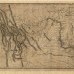
This map of the western part of the Lewis and Clark Expedition was drawn by Samuel Lewis (no relation to Meriwether) using drawings supplied by William Clark.
New Unit Plan Created: A Map Study of the Battle of Gettysburg
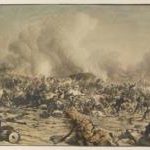
The resource takes a slightly unconventional approach to studying and understanding the battle. Rather than a traditional lesson about the events, A Map Study of the Battle of Gettysburg uses two maps of the town, both ca. 1863, and its surrounding areas to understand how the battle unfolded and resulted in a Union victory because of the geography.
The Geography of the United States (CKHG Unit)
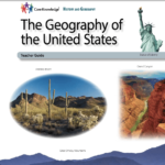
This unit reinforces map and globe skills as students learn about the geographic characteristics of different regions of the United States: New England, Mid-Atlantic, South, Midwest, Great Plains, Rocky Mountain, Southwest, and West Coast. Across 13 lessons, students explore the climate, natural resources, culture, and other distinctive characteristics of each region.
Women, Their Rights and Nothing Less: The First Amendment and the Women’s Suffrage Movement
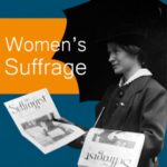
Use this map to explore how the women’s suffrage movement — and the people who opposed it — tried to influence public opinion. Explore artifacts from billboards and cards to buttons and cartoons. You’ll uncover the wide array of tools and tactics each side used to spread its message, and you’ll see how geography and other factors shaped the form and content of their communication.
Rucho v. Common Cause (2019)
This case explores the following issues: Do Common Cause and the League of Women Voters of North Carolina (the plaintiffs) have constitutional standing to make these partisan gerrymandering challenges? Are the plaintiffs’ partisan gerrymandering claims able to be heard by the Court? If plaintiffs have standing and their claims are justiciable, is North Carolina’s 2016 congressional map an unconstitutional partisan gerrymander?
Fact Finder: Your Foolproof Guide to Media Literacy
Are your students savvy searchers? Can they spot the difference between a straight news article and an opinion piece? Do they recognize bias in their sources … or in themselves?
Tackle these challenges and more using Fact Finder’s 11 flexible, multimedia lesson plans. Eight skill-building lesson plans introduce essential media literacy concepts through engaging explainer videos and colorful infographics that help students revisit, retain and apply the key concepts. The accompanying News or Noise? Media Map provides a collection of examples ready for students to analyze and evaluate with the support of worksheets and discussion prompts. Three reporting lesson plans help students take what they’ve learned and apply it to their own content creation, inspired by the issues that matter to them.
The Earliest Americans (CKHG Unit)
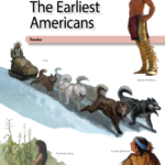
Across 17 lessons, this unit introduces some of the different peoples who populated America many years before the arrival of European explorers—some as early as thirty thousand years ago along the Pacific Coast, and others who traveled from Asia across Beringia, the land bridge. Students explore how these early peoples spread across North and South America, adapted to their environments and developed unique cultures. Each lesson is designed to last 30 minutes.
Westward Expansion After the Civil War (CKHG Unit)
This unit focuses on the westward movement of Americans in the later 1800s, which often led to conflict with Native Americans displaced from long inhabited lands. Across 7 lessons, students learn about the lure of gold or silver, or the land offered through the Homestead Act. Students explore the transcontinental railroads, the “Wild West,” the purchase of Alaska, and the “closing of the American frontier.”
Westward Expansion Before the Civil War (CKHG Unit)
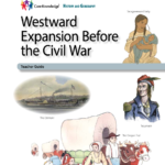
The unit explores the westward movement of Americans in the nineteenth century: the early explorers, effects of new developments in transportation, Native American resistance to settlers, and the treaties broken by government officials. Across 10 lessons, students explore the use of Manifest Destiny to promote the acquisition of US territory, the annexation of Texas, the Oregon Trail, and the California gold rush.
The Age of Exploration (CKHG Unit)
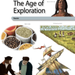
This unit introduces students to European exploration and trade from 1400 to the 1600s. Across 12 lessons, students learn about motivations for European exploration and study specific explorers, learning about their encounters with indigenous peoples. Students are introduced to the early slave trade and the beginnings of slavery in the Americas.